Image credits : Defense.info
1 Introduction
1.1 Orogenesis
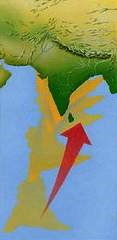
Mountain belts which are created by continent-continent collision represent the most dominant and unique geologic features on the surface of the Earth. Some of the best examples of such continent-continent collision which lead to orogenesis are the Rockies and the Appalachian belt in North America, the Andes in the South America, the Ural Mountains in central Eurasia, the Alps of Europe and the Himalayas in Asia. The youngest and the most impressing of all the continent-continent collisional belts on the Earth is the Himalayan orogeny. The Himalayan Mountain ranges are the product of collision between the India and Eurasian plate and a live example of collision mountain belt as the process of mountain building is still active, forming the highest range and plateau in the world.
1.2 Tectonostratigraphic Subdivision of the Himalayas
The Himalayan Mountain belt extends over 2500 km from northwest to northeast with a variable width of 230 to 330 km. The Himalayan terrain from South to North has been divided into subparallel tectonostratigraphic subdivisions as under:
- Sub-Himalaya or Outer Himalaya.
- Lower Himalaya or Lesser Himalaya.
- Higher Himalaya or Greater Himalaya.
- Trans Himalaya or Tibetan Himalaya.

The dividing planes between these subdivisions are the thrusts of regional dimension and varying tectonic activities and each subdivision has a characteristic stratigraphy which is not easily correctable with adjacent zones. From south to north, bounding faults are:
- Main Frontal thrust (MFT): Between Indo-Gangetic alluvial planes and Outer Himalayas.
- Main Boundary Thrust (MBT): Between Outer Himalayas and Lesser Himalayas.
- Main Central Thrust (MCT): Between Lesser Himalayas and Greater Himalayas.
- Southern Tibetan Detachment system (STD): Between Greater Himalaya and Trans Himalayas.
Along each of these thrusts, tens to hundreds of kilometres of displacement between India and Asia have been accommodated, which in turn exert a major influence on landsliding and many devastating landslides are associated with movements along these thrusts.

1.3 Tunnelling in the Himalayas
A huge infrastructural development in these mountainous regions is planned by the government’s active support of the sector. The government plans to build massive hydroelectric projects in these mountainous ranges to tap the renewable energy from gushing rivers, road tunnels to connect the remote locations so that all-weather connectivity can be provided to the locals and the Armed forces of the nation and rail tunnels to connect the remotest location with the rail lines so that transportation which once was a daunting task will now be a smoother daily commute. All these underground structures have been planned in the complex geology of the Himalayas in an extremely nearby vicinity to the tectonostratigraphic divisions mentioned above.
Hence, with this article, I endeavor to present the vagaries involved in underground construction by sharing certain case studies of projects constructed or are planned to be constructed in this complex geological mammoth so that the readers can have an idea and implement the measures in their respective projects. I have also included the relevant mitigation measures and precautions to be taken to avoid any accident owing to the geological uncertainty which sometimes becomes highly certain if proper steps are not taken.
2. The real challenges of tunnelling in the Himalayas
Tunnelling through the weak, fragile, jointed rock masses of the Himalayas is challenging. Almost in all the tunnelling projects of Himalayas some or other type of tunnelling problems have been encountered and are still being faced; like Fault/thrust/shear zones, running ground conditions, heaving, squeezing and swelling, rock bursting, ground water inflow, hot temperature conditions and gases in rock, wedge/block failures, etc. Though it is a non-welcoming situation, this follows a lot of learning. The challenges faced in different projects are briefly presented in the next section.
3. Case studies
3.1 Fault/Thrust/Shear Zones:
Due to the active tectonic zone, encounter with fault/thrust/shear zone while tunneling in the Himalayas is inevitable. A shear zone is a zone with sub-parallel walls in which deformations are localized due to folding, faulting, and thrusting. The shear zones if combined with water ingress, which occurs usually, hampers the progress of tunnelling considerable and in some cases applies a complete break.
- Dul-Hasti Hydroelectric project:
The 390 MW Dul-Hasti hydropower project is a run-of-the-river scheme, constructed on river Chandra, a tributary of river Chenab, lies within Lesser Himalayan Zone and is characterized by unique plateau like feature with schists and gniesses on western side and quartzites on eastern side. The tunnel encountered a number of small and major faults and shear zones having crushed gouge material.